File:Imola.svg
Jump to navigation
Jump to search


Size of this PNG preview of this SVG file: 800 × 434 pixels. Other resolutions: 320 × 173 pixels | 640 × 347 pixels | 1,024 × 555 pixels | 1,280 × 694 pixels | 1,306 × 708 pixels.
Original file (SVG file, nominally 1,306 × 708 pixels, file size: 51 KB)
Summary
| Description |
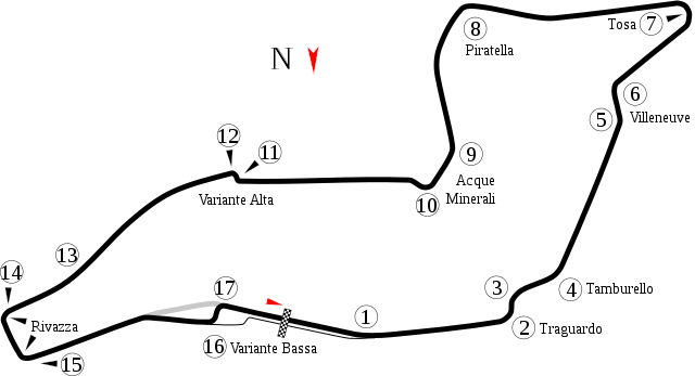
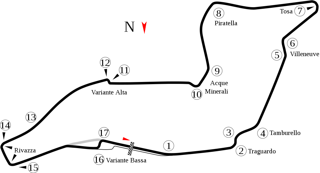
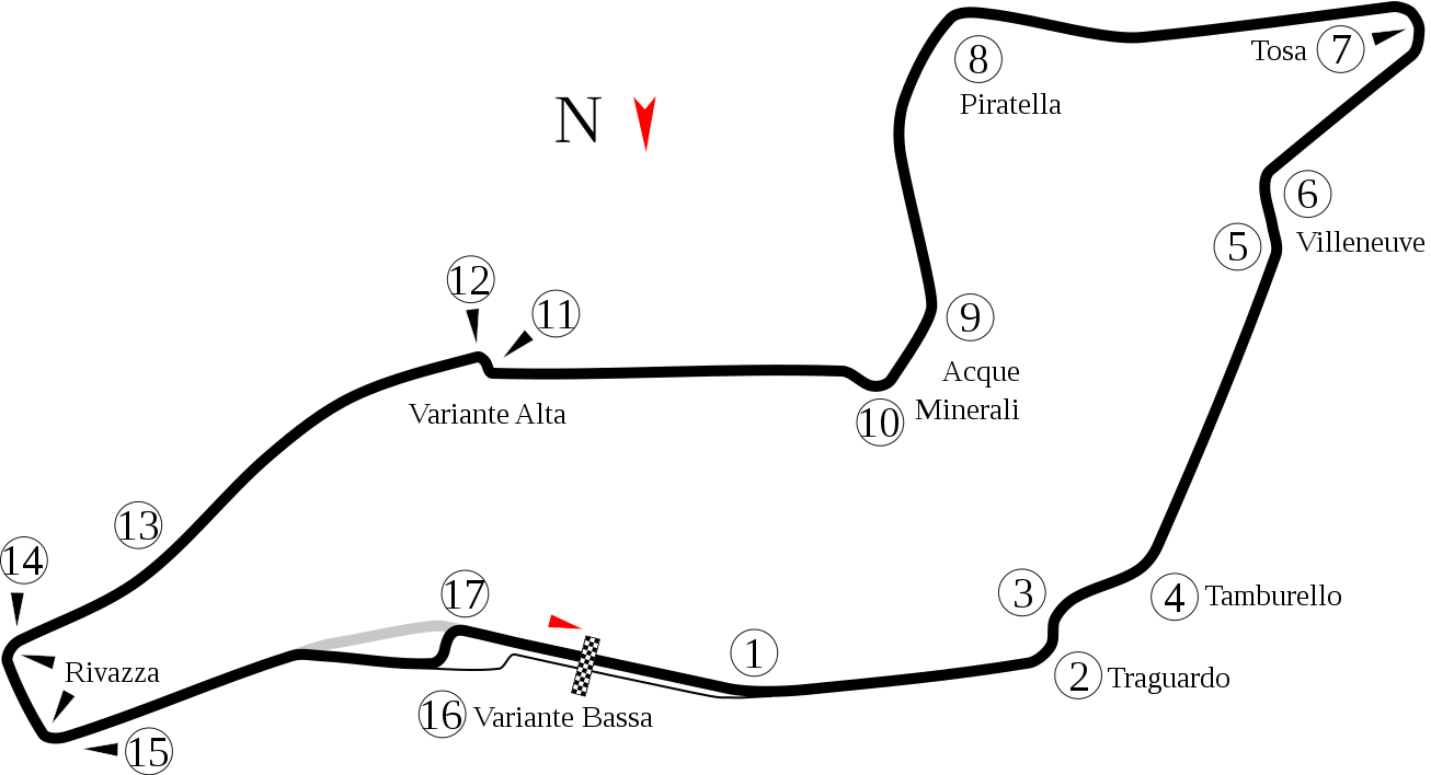
English: Track map of the Autodromo Internazionale Enzo e Dino Ferrari, known as the Imola Circuit. This shows the pre-2008 layout. For the 2008-present layout, see File:Imola 2009.svg |
| Date | |
| Source | Own work |
| Author | Will Pittenger |
| Other versions |
|


| Camera location | | View this and other nearby images on: OpenStreetMap |
|---|
Licensing
I, the copyright holder of this work, hereby publish it under the following license:
This file is licensed under the Creative Commons Attribution 3.0 Unported license.
- You are free:
- to share – to copy, distribute and transmit the work
- to remix – to adapt the work
- Under the following conditions:
- attribution – You must give appropriate credit, provide a link to the license, and indicate if changes were made. You may do so in any reasonable manner, but not in any way that suggests the licensor endorses you or your use.
File history
Click on a date/time to view the file as it appeared at that time.
| Date/Time | Thumbnail | Dimensions | User | Comment | |
|---|---|---|---|---|---|
| current | 09:08, 21 February 2012 | | 1,306 × 708 (51 KB) | Restu20 | Correct a mistake |
File usage
There are no pages that use this file.